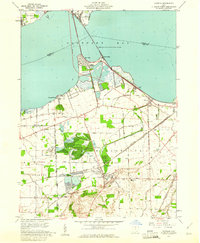
1959 Map of Castalia
USGS Topo · Published 1965About this map
Sandusky Bay dominates the northern reaches of this coastal landscape, where the New York Central and New York Chicago And ST Louis Railroad converge near Bay Bridge. This mid-century survey illustrates the industrial and natural transition of Erie Co and Sandusky Co, particularly around Castalia. The presence of Former Strip Mines and various active Quarry sites reflects the region's extraction history, while the Resthaven Wildlife Area and the Blue Hole spring signify a shift toward conservation and recreation. Notable local landmarks like the Castalia Trout Club and Trinity Ch appear alongside the intricate grid of the Connecticut Lands Reserve Boundary. These survey details reveal the evolving land use as commercial shipping, rail transport, and natural springs shaped the communities of Venice and Crystal Rock.
Find a feature on this map
47 named features on this map. Tap any name to fly to it.
Don’t see what you’re looking for? This feature index may not catch every label — zoom into the map to look around manually.
Map Details
Editions of this 1959 Castalia Map
This is the sole edition of this map. No revisions or reprints were ever made.
Other maps of this area

1901 · Put-In-Bay
USGS Topo · 1:62,500

1901 · Bellevue
USGS Topo · 1:62,500

1903 · Bellevue
USGS Topo · 1:62,500

1903 · Put In Bay
USGS Topo · 1:62,500

1904 · Sandusky
USGS Topo · 1:62,500

1916 · Kelleys Island
USGS Topo · 1:62,500

1919 · Kelleys Island
USGS Topo · 1:62,500

1956 · Toledo
USGS Topo · 1:250,000

1957 · Vickery
USGS Topo · 1:24,000

1959 · Kimball
USGS Topo · 1:24,000