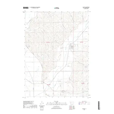
2018 Map of Castana
USGS Topo · Published 2018About this map
The Maple River valley dictates the geography of this Monona County landscape, cutting a wide diagonal path through the loess hills of western Iowa. The village of Castana sits tucked into the eastern bluffs where Cottonwood Cr meets the main river valley, while Turin occupies the flatlands further south near the confluence with the Little Sioux River. This area is defined by a series of deeply incised drainage patterns, represented by features like Nutt Hollow, Dutch Hollow, and Gingles Hollow, which separate prominent rises such as Durr Hill and Granger Hill.
Find a feature on this map
51 named features on this map. Tap any name to fly to it.
Don’t see what you’re looking for? This feature index may not catch every label — zoom into the map to look around manually.
Map Details
Editions of this 2018 Castana Map
This is the sole edition of this map. No revisions or reprints were ever made.
Other maps of this area

1954 · Omaha
USGS Topo · 1:250,000

1954 · Fort Dodge
USGS Topo · 1:250,000

1955 · Sioux City
USGS Topo · 1:250,000

1955 · Fremont
USGS Topo · 1:250,000

1957 · Fremont
USGS Topo · 1:250,000

1957 · Omaha
USGS Topo · 1:250,000

1957 · Fort Dodge
USGS Topo · 1:250,000

1958 · Sioux City
USGS Topo · 1:250,000

1958 · Omaha
USGS Topo · 1:250,000

1958 · Fremont
USGS Topo · 1:250,000