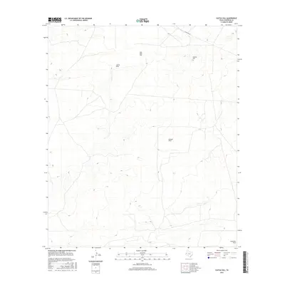
2016 Map of Castile Hill
USGS Topo · Published 2016About this map
Castile Hill serves as a central high point in this Culberson County landscape, where the terrain is defined by dry drainage systems and subtle topographical shifts. The intermittent waterways of Castile Draw and Kimbell Draw weave through the region, illustrating the arid hydrology of West Texas. The presence of Sink Hole Flat suggests the specific geological processes at work beneath the surface, while the southern reach includes the winding path of Horseshoe Draw. Civil infrastructure is limited to the corridor of Ranch Rd 652 in the northern portion of the quadrangle, reflecting the sparse settlement and open range characteristic of this part of the Chihuahuan Desert.
Find a feature on this map
6 named features on this map. Tap any name to fly to it.
Don’t see what you’re looking for? This feature index may not catch every label — zoom into the map to look around manually.
Map Details
Editions of this 2016 Castile Hill Map
This is the sole edition of this map. No revisions or reprints were ever made.
Other maps of this area

1954 · Van Horn
USGS Topo · 1:250,000

1958 · Van Horn
USGS Topo · 1:250,000

1973 · Seven L Peak
USGS Topo · 1:24,000

1973 · Owl Hills
USGS Topo · 1:24,000

1973 · Seven L Peak NE
USGS Topo · 1:24,000

1973 · Rustler Hills
USGS Topo · 1:24,000

1973 · Screw Bean Draw West
USGS Topo · 1:24,000

1973 · Delaware Spring
USGS Topo · 1:24,000
1973 · Castile Hill
USGS Topo · 1:24,000
1973 · Outlaw Spring
USGS Topo · 1:24,000