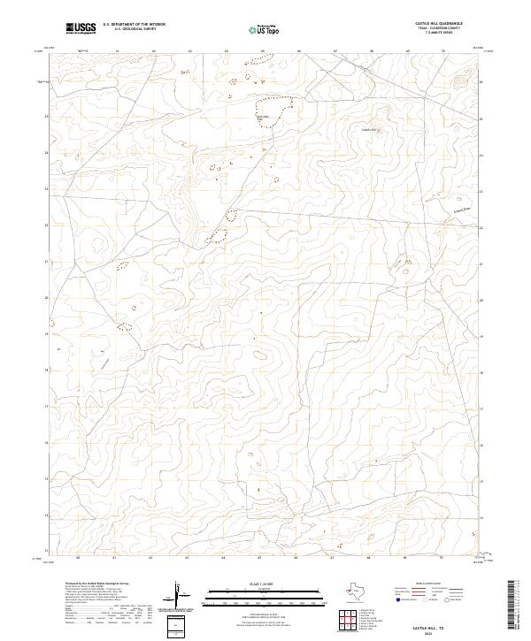
2022 Map of Castile Hill
USGS Topo · Published 2022About this map
Sink Hole Flat defines the upper portion of this arid landscape, situated in a remote corner of Culberson County where the high desert meets the northern Chihuahuan plains. The eponymous Castile Hill rises above the surrounding terrain, overlooking a network of ephemeral watercourses including Castile Draw and Kimbell Draw. These drainage patterns are the primary markers of the local geography, illustrating the hydrological behavior of the basin. Transport across this sparsely populated region is facilitated by Ranch Rd 652, which cuts through the northeastern corner of the map. The sparse labeling on this 2022 survey reflects the open, undeveloped character of this rangeland, where the primary features are geomorphological rather than man-made.
Find a feature on this map
5 named features on this map. Tap any name to fly to it.
Don’t see what you’re looking for? This feature index may not catch every label — zoom into the map to look around manually.
Map Details
Editions of this 2022 Castile Hill Map
This is the sole edition of this map. No revisions or reprints were ever made.
Other maps of this area

1954 · Van Horn
USGS Topo · 1:250,000

1958 · Van Horn
USGS Topo · 1:250,000

1973 · Seven L Peak
USGS Topo · 1:24,000

1973 · Owl Hills
USGS Topo · 1:24,000

1973 · Seven L Peak NE
USGS Topo · 1:24,000

1973 · Rustler Hills
USGS Topo · 1:24,000

1973 · Screw Bean Draw West
USGS Topo · 1:24,000

1973 · Delaware Spring
USGS Topo · 1:24,000
1973 · Castile Hill
USGS Topo · 1:24,000
1973 · Outlaw Spring
USGS Topo · 1:24,000