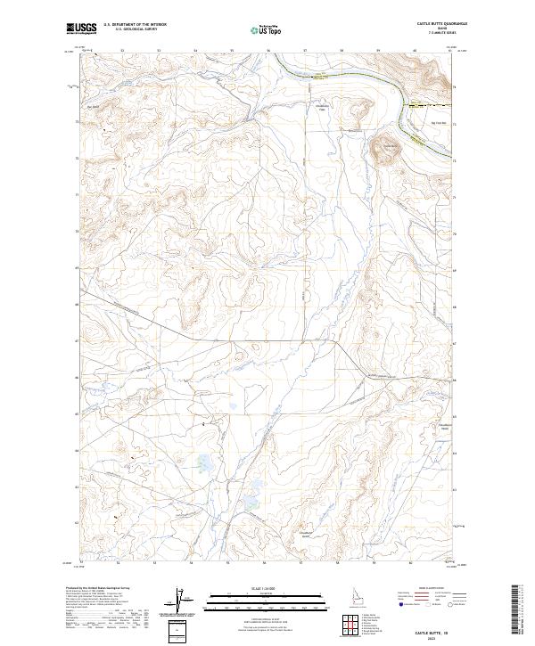
2023 Map of Castle Butte
USGS Topo · Published 2023About this map
Snake River frontage and the convergence of Owyhee, Ada, and Elmore Counties characterize this high desert landscape. The terrain is marked by significant hydrological features and historical corridors, notably the Emigrant Trl which traverses the northern reaches and eastern benchlands. Dominating the local topography, Castle Butte rises above the drainage of Castle Creek, while the Big Foot Bar sits along a bend in the river. Local habitation and ranching history are evident through named areas like Rye Patch and Henderson Flats. The map documents a complex network of seasonal drainages, including Catherine Creek, Cloudburst Wash, and Garbutt Wash, which carve through the plains. Transportation is supported by a mix of long-established routes such as Murphy-Grandview Rd and localized infrastructure like the Castle Creek Cutoff and Steiner Valley Rd.
Find a feature on this map
37 named features on this map. Tap any name to fly to it.
Don’t see what you’re looking for? This feature index may not catch every label — zoom into the map to look around manually.
Map Details
Editions of this 2023 Castle Butte Map
This is the sole edition of this map. No revisions or reprints were ever made.
Other maps of this area

1892 · Bisuka
USGS Topo · 1:125,000

1894 · Bisuka
USGS Topo · 1:125,000

1947 · Grand View
USGS Topo · 1:62,500

1947 · Jackass Butte
USGS Topo · 1:24,000

1947 · Wild Horse Butte
USGS Topo · 1:24,000

1947 · Vinson Wash
USGS Topo · 1:24,000

1948 · Castle Butte
USGS Topo · 1:24,000

1948 · Vinson Wash
USGS Topo · 1:24,000

1948 · Big Foot Butte
USGS Topo · 1:24,000

1948 · Wild Horse Butte
USGS Topo · 1:24,000