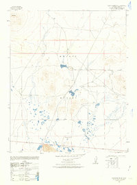
1947 Map of Castle Butte SE
USGS Topo · Published 1963About this map
Mojave Desert terrain dominates this 1947 survey, revealing a landscape defined by isolated peaks and seasonal water features. The prominent Castle Butte stands as a primary navigational landmark in the northwest corner, while the Eighth Standard Parallel South serves as a critical survey boundary line across the arid flats. This military-derived compilation captures the area during a period of transition, showing sparse but significant human activity in an environment where water resources were paramount. Evidence of ranching and early habitation appears at Thundering Herd Ranch and the settlement of North Muroc, while a lone Windmill suggests the vital role of groundwater for survival in this dry stretch of Kern County. The map is a precise record of the desert's character before later developments, detailing the network of unimproved roads and trails that connected these remote outposts.
Find a feature on this map
6 named features on this map. Tap any name to fly to it.
Don’t see what you’re looking for? This feature index may not catch every label — zoom into the map to look around manually.
Map Details
Editions of this 1947 Castle Butte SE Map
3 editions found
Other maps of this area

1915 · Searles Lake
USGS Topo · 1:250,000

1937 · Kramer
USGS Topo · 1:48,000

1937 · Rogers Lake
USGS Topo · 1:48,000

1942 · Kramer
USGS Topo · 1:62,500

1942 · Rogers Lake
USGS Topo · 1:62,500

1943 · Castle Butte
USGS Topo · 1:62,500

1947 · Fluhr
USGS Topo · 1:24,000

1947 · Castle Butte
USGS Topo · 1:50,000

1947 · Rich
USGS Topo · 1:24,000

1947 · Desert Butte
USGS Topo · 1:24,000