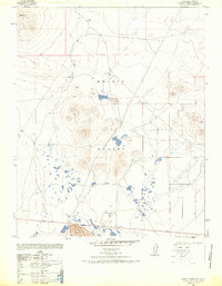
1947 Map of Castle Butte SE
USGS Topo · Published 1968About this map
The Mojave Desert terrain of eastern Kern County is captured here just after the war, based on 1946 aerial photography and 1947 field editing. This area is characterized by sparse desert improvements and isolated landmarks like the Thundering Herd Ranch and a lonely Windmill situated near the Eighth Standard Parallel South. The survey highlights the significant natural rise of Castle Butte, providing a detailed look at the landforms and tracks that once guided travel through this arid landscape during the mid-20th century. Prepared by the Army Map Service and reprinted for civil use, the map emphasizes basic infrastructure and terrain markers essential for navigation and desert ranching life in the late 1940s.
Find a feature on this map
5 named features on this map. Tap any name to fly to it.
Don’t see what you’re looking for? This feature index may not catch every label — zoom into the map to look around manually.
Map Details
Editions of this 1947 Castle Butte SE Map
3 editions found
Other maps of this area

1915 · Searles Lake
USGS Topo · 1:250,000

1937 · Kramer
USGS Topo · 1:48,000

1937 · Rogers Lake
USGS Topo · 1:48,000

1942 · Kramer
USGS Topo · 1:62,500

1942 · Rogers Lake
USGS Topo · 1:62,500

1943 · Castle Butte
USGS Topo · 1:62,500

1947 · Fluhr
USGS Topo · 1:24,000

1947 · Castle Butte
USGS Topo · 1:50,000

1947 · Rich
USGS Topo · 1:24,000

1947 · Desert Butte
USGS Topo · 1:24,000