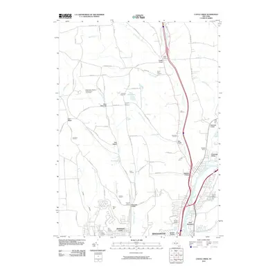
2010 Map of Castle Creek
USGS Topo · Published 2010About this map
Binghamton Regional Airport-Edwin A Link Field sits as a prominent landmark on the high ground west of the Chenango River valley. This 2010 survey illustrates the suburban and rural landscape north of Johnson City and Binghamton, where long-established cemeteries like Baptist Church Cemetery and Sacred Heart Cemetery are scattered among newer residential developments. The area's agricultural roots remain visible through features such as the Apple Hills Fruit Farm and the Broome County Jail Farm. Settlements like Glen Castle, Castle Creek, and Choconut Center follow the paths of their namesake waterways, including Castle Creek and Little Choconut Creek. The map provides a detailed view of these small communities as they expanded outward from the city centers during the early 21st century, showing a transition from the dense streets of Port Dickinson to the hilly terrain of Deyo Hill and West Chenango.
Find a feature on this map
95 named features on this map. Tap any name to fly to it.
Don’t see what you’re looking for? This feature index may not catch every label — zoom into the map to look around manually.
Map Details
Editions of this 2010 Castle Creek Map
This is the sole edition of this map. No revisions or reprints were ever made.
Other maps of this area

1901 · Apalachin
USGS Topo · 1:62,500

1903 · Harford
USGS Topo · 1:62,500

1904 · Binghamton
USGS Topo · 1:62,500

1904 · Greene
USGS Topo · 1:62,500

1904 · Apalachin
USGS Topo · 1:62,500

1906 · Catatonk
USGS Topo · 1:125,000

1934 · Castle Creek
USGS Topo · 1:24,000

1935 · Binghamton West
USGS Topo · 1:24,000

1935 · Chenango Forks
USGS Topo · 1:24,000

1937 · Binghamton East
USGS Topo · 1:24,000