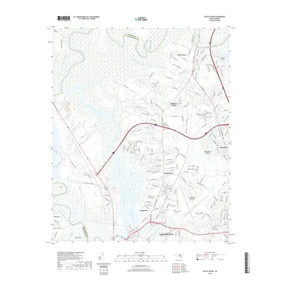
2019 Map of Castle Hayne
USGS Topo · Published 2019About this map
The Northeast Cape Fear River dominates this landscape north of Wilmington, where the river winds through extensive wetlands like Dollsons Swamp before its confluence near Eagle Island. This era is defined by the significant infrastructure surrounding the city, including the expansive Wilmington International Airport and the heavy industrial presence at Lake Sutton near the Sutton Steam Plant Road. Residential development is concentrated in established communities like Wrightsboro and Castle Hayne, while smaller enclaves such as Skippers Corner and Hightsville sit along the primary corridors leading into the city. The map also documents local history through sites like the Shoulder Branch Cem, situated near the edge of the wetlands, and the transition of rural tracts such as Blue Clay Farms into the suburban fabric of New Hanover County.
Find a feature on this map
176 named features on this map. Tap any name to fly to it.
Don’t see what you’re looking for? This feature index may not catch every label — zoom into the map to look around manually.
Map Details
Editions of this 2019 Castle Hayne Map
This is the sole edition of this map. No revisions or reprints were ever made.
Other maps of this area

1942 · Wilmington
USGS Topo · 1:62,500

1943 · Winnabow
USGS Topo · 1:24,000

1944 · Winnabow
USGS Topo · 1:31,680

1947 · Rocky Point
USGS Topo · 1:62,500

1948 · Wilmington
USGS Topo · 1:62,500

1950 · Winnabow
USGS Topo · 1:25,000

1953 · Florence
USGS Topo · 1:250,000

1953 · Beaufort
USGS Topo · 1:250,000

1954 · Florence
USGS Topo · 1:250,000

1954 · Beaufort
USGS Topo · 1:250,000