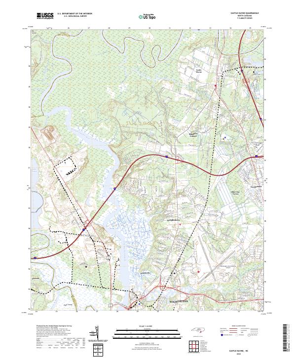
2022 Map of Castle Hayne
USGS Topo · Published 2022About this map
The Northeast Cape Fear River dominates this landscape, winding southward toward its confluence near Wilmington. The map details the transition from the riverine lowlands and marshes of Dollsons Swamp and Eagle Island to the expanding residential and industrial corridors north of the city. Suburban developments such as Northchase and Blue Clay Farms are contrasted with older rural identifiers like Skippers Corner and Wrightsboro.
Find a feature on this map
178 named features on this map. Tap any name to fly to it.
Don’t see what you’re looking for? This feature index may not catch every label — zoom into the map to look around manually.
Map Details
Editions of this 2022 Castle Hayne Map
This is the sole edition of this map. No revisions or reprints were ever made.
Other maps of this area

1942 · Wilmington
USGS Topo · 1:62,500

1943 · Winnabow
USGS Topo · 1:24,000

1944 · Winnabow
USGS Topo · 1:31,680

1947 · Rocky Point
USGS Topo · 1:62,500

1948 · Wilmington
USGS Topo · 1:62,500

1950 · Winnabow
USGS Topo · 1:25,000

1953 · Florence
USGS Topo · 1:250,000

1953 · Beaufort
USGS Topo · 1:250,000

1954 · Florence
USGS Topo · 1:250,000

1954 · Beaufort
USGS Topo · 1:250,000