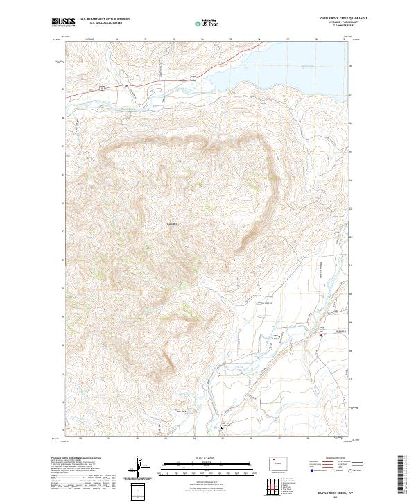
2021 Map of Castle Rock Creek
USGS Topo · Published 2021About this map
Sheep Mtn dominates the central landscape of this western Wyoming quadrangle, serving as a divide between the drainages of the North Fork Shoshone River and the South Fork Shoshone River. The presence of the Buffalo Bill Reservoir in the northeast corner signifies the regional importance of water management, further evidenced by an extensive network of irrigation infrastructure including the Watson-Mekissick Ditch, Castle Rock Ditch, and Lakeview Ditch. These diversions highlight the adaptation of the arid terrain for agricultural and ranching use.
Find a feature on this map
50 named features on this map. Tap any name to fly to it.
Don’t see what you’re looking for? This feature index may not catch every label — zoom into the map to look around manually.
Map Details
Editions of this 2021 Castle Rock Creek Map
This is the sole edition of this map. No revisions or reprints were ever made.
Other maps of this area

1949 · Pat O'Hara Mountain
USGS Topo · 1:62,500

1949 · Cody
USGS Topo · 1:62,500

1951 · Cody
USGS Topo · 1:62,500

1955 · Cody
USGS Topo · 1:250,000

1957 · Wapiti
USGS Topo · 1:62,500

1957 · Devils Tooth
USGS Topo · 1:62,500

1958 · Cody
USGS Topo · 1:250,000

1962 · Cody
USGS Topo · 1:250,000

1980 · Carter Mountain
USGS Topo · 1:100,000

1980 · Cody
USGS Topo · 1:100,000