
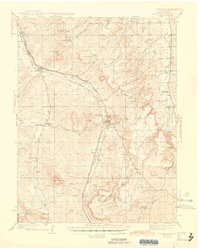
1945 Map of Castle Rock
USGS Topo · Published 1945About this map
Castle Rock serves as the central hub of this Douglas County landscape, situated at the confluence of the East Plum Creek and the surrounding plateau. The map details a sophisticated transport corridor where the Denver and Rio Grande Western and Atchison Topeka and Santa Fe railroads run nearly parallel through the Plum Creek valley. This infrastructure reflects the region's mid-century role as a vital link between Denver and points south, balanced by a rural network of family-named landmarks and rural education centers like Fonder Sch and Oakland Sch.
Find a feature on this map
52 named features on this map. Tap any name to fly to it.
Don’t see what you’re looking for? This feature index may not catch every label — zoom into the map to look around manually.
Map Details
Editions of this 1945 Castle Rock Map
2 editions found
Other maps of this area

1890 · East Denver
USGS Topo · 1:125,000

1893 · Platte Canyon
USGS Topo · 1:125,000

1894 · Castle Rock
USGS Topo · 1:125,000

1899 · West Denver
USGS Topo · 1:125,000

1913 · Castle Rock
USGS Topo · 1:125,000

1935 · East Denver Nos. 3 and 4
USGS Topo · 1:48,000

1939 · Elizabeth
USGS Topo · 1:62,500

1940 · Piney Creek
USGS Topo · 1:24,000

1940 · Elbert
USGS Topo · 1:62,500

1940 · Castle Rock
USGS Topo · 1:62,500