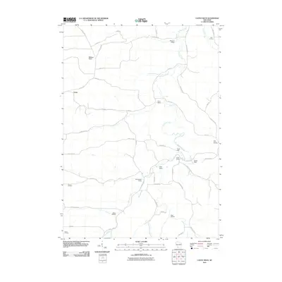
2010 Map of Castle Rock
USGS Topo · Published 2010About this map
Hickory Grove and the small crossroads of Homer anchor this pocket of Grant County, where the topography is defined by the dendritic drainage of the Fennimore Fork. The landscape is a complex network of named coulees and valleys, including Coon Valley, Crow Valley, and Gunderson Valley, which reveal a settlement pattern dictated by the winding watercourses and steep ridges of the Driftless Area. This 2010 survey documents the rural character of the region, where family names are preserved through a series of small, dispersed burial grounds such as Pipal Cemetery in the northeast and German Cemetery to the west. Roads like Blue School Rd and Church Rd hint at former community centers in the hollows. The presence of Cedar Cliff and the namesake Castle Rock highlight the distinctive rocky outcrops that rise above the valley floors, providing a clear picture of the area's agricultural and natural layout at the start of the 21st century.
Find a feature on this map
45 named features on this map. Tap any name to fly to it.
Don’t see what you’re looking for? This feature index may not catch every label — zoom into the map to look around manually.
Map Details
Editions of this 2010 Castle Rock Map
This is the sole edition of this map. No revisions or reprints were ever made.
Other maps of this area

1900 · Lancaster
USGS Topo · 1:125,000

1902 · Mineral Point
USGS Topo · 1:125,000

1904 · Lancaster
USGS Topo · 1:125,000

1905 · Richland Center
USGS Topo · 1:125,000

1908 · Lancaster
USGS Topo · 1:125,000

1933 · Boscobel
USGS Topo · 1:62,500

1952 · Montfort
USGS Topo · 1:24,000

1958 · La Crosse
USGS Topo · 1:250,000

1959 · Dubuque
USGS Topo · 1:250,000

1960 · Muscoda
USGS Topo · 1:62,500