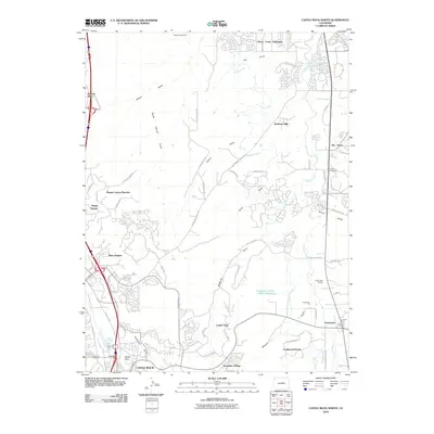
2010 Map of Castle Rock North
USGS Topo · Published 2010About this map
Cherry Creek and its many tributary gulches define the landscape north of Castle Rock, where suburban expansion meets the region's ranching and mining history. The map captures a moment of significant residential growth, showing established and emerging neighborhoods like Founders Village, Castlewood North, and The Pinery spread across the high terrain. Historical markers of the earlier frontier era remain visible, including the Newlin Gulch Mine in the north and the Leonard Mine near Franktown. The complex network of the Arapahoe Canal weaves through the eastern half of the quadrangle, illustrating the importance of water management in this part of Douglas County. Cultural landmarks such as the Pikes Peak Grange and several community burial grounds, including Cedar Hill Cemetery and Franktown Cemetery, provide specific points of interest for those tracing local family lineages or the evolution of these Front Range communities.
Find a feature on this map
61 named features on this map. Tap any name to fly to it.
Don’t see what you’re looking for? This feature index may not catch every label — zoom into the map to look around manually.
Map Details
Editions of this 2010 Castle Rock North Map
This is the sole edition of this map. No revisions or reprints were ever made.
Other maps of this area

1890 · East Denver
USGS Topo · 1:125,000

1894 · Castle Rock
USGS Topo · 1:125,000

1913 · Castle Rock
USGS Topo · 1:125,000

1935 · East Denver Nos. 3 and 4
USGS Topo · 1:48,000

1939 · Elizabeth
USGS Topo · 1:62,500

1940 · Piney Creek
USGS Topo · 1:24,000

1940 · Castle Rock
USGS Topo · 1:62,500

1942 · Highland Ranch
USGS Topo · 1:31,680

1942 · Parker
USGS Topo · 1:31,680

1942 · Piney Creek
USGS Topo · 1:31,680