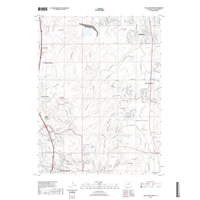
2019 Map of Castle Rock North
USGS Topo · Published 2019About this map
Parker and Castle Rock define the northern and southern poles of this suburbanized corridor in Douglas County, where the landscape is increasingly shaped by residential developments like The Pinery and Castle Pines. The drainage of Cherry Creek remains a central geographic feature, accompanied by an extensive network of recreational paths including the Cherry Creek Trail and the Bayou Gulch Cherry Creek Connector Trail. Public infrastructure is concentrated near the southern edge, notably the Robert A Christensen Justice Center - Douglas County Courthouse and the Arapahoe Community College - Castle Rock Campus. Further out, the terrain is marked by traditional water management features like the Arapahoe Canal and the Franktown Parker FPM-1 Reservoir. For those tracing local heritage, the map identifies the Parker Cem and Franktown Cem along the eastern foothills.
Find a feature on this map
50 named features on this map. Tap any name to fly to it.
Don’t see what you’re looking for? This feature index may not catch every label — zoom into the map to look around manually.
Map Details
Editions of this 2019 Castle Rock North Map
This is the sole edition of this map. No revisions or reprints were ever made.
Other maps of this area

1890 · East Denver
USGS Topo · 1:125,000

1894 · Castle Rock
USGS Topo · 1:125,000

1913 · Castle Rock
USGS Topo · 1:125,000

1935 · East Denver Nos. 3 and 4
USGS Topo · 1:48,000

1939 · Elizabeth
USGS Topo · 1:62,500

1940 · Piney Creek
USGS Topo · 1:24,000

1940 · Castle Rock
USGS Topo · 1:62,500

1942 · Highland Ranch
USGS Topo · 1:31,680

1942 · Parker
USGS Topo · 1:31,680

1942 · Piney Creek
USGS Topo · 1:31,680