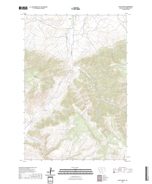
2024 Map of Castle Rocks
USGS Topo · Published 2024About this map
Pryor serves as the primary hub in this northern section of the Pryor Mountains, where the landscape is defined by the dramatic ascent of West Pryor Mountain. The map illustrates a complex relationship between high-altitude terrain and the vital water management systems necessary for the valley, including the Pryor Ditch-Number One and Lost Creek Ditch. These irrigation features, along with Pryor Creek and Bird Creek, trace the lowlands beneath the steep contours of Pryor Gap.
Find a feature on this map
33 named features on this map. Tap any name to fly to it.
Don’t see what you’re looking for? This feature index may not catch every label — zoom into the map to look around manually.
Map Details
Editions of this 2024 Castle Rocks Map
This is the sole edition of this map. No revisions or reprints were ever made.
Other maps of this area

1954 · Billings
USGS Topo · 1:250,000

1957 · Billings
USGS Topo · 1:250,000

1958 · Billings
USGS Topo · 1:250,000

1964 · Big Ice Cave
USGS Topo · 1:24,000

1967 · Castle Rocks
USGS Topo · 1:24,000

1967 · Deep Creek
USGS Topo · 1:24,000

1967 · Pryor
USGS Topo · 1:24,000

1967 · Deep Creek SW
USGS Topo · 1:24,000

1967 · Section House Draw
USGS Topo · 1:24,000
1967 · Pryor NW
USGS Topo · 1:24,000