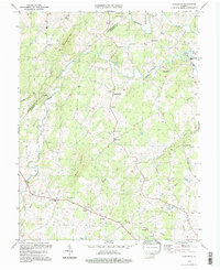
1994 Map of Castleton
USGS Topo · Published 1997About this map
The Thornton River and Hazel River carve through this landscape at the boundary of Rappahannock and Culpeper Counties, defining a region where agricultural settlements are often oriented around watercourses and modest mountain gaps. Small crossroads like Eggbornsville and Eldorada anchor the rural road network, while Castleton sits at the foot of Castleton Mtn. The prevalence of small country sanctuaries, including Gourdvine Ch, Beulah Ch, and New Salem Ch, reflects a deeply rooted community structure characteristic of the Virginia Piedmont.
Find a feature on this map
37 named features on this map. Tap any name to fly to it.
Don’t see what you’re looking for? This feature index may not catch every label — zoom into the map to look around manually.
Map Details
Editions of this 1994 Castleton Map
3 editions found
Other maps of this area

1887 · Spottsylvania
USGS Topo · 1:125,000

1892 · Spottsylvania
USGS Topo · 1:125,000

1892 · Gordonsville
USGS Topo · 1:125,000

1893 · Luray
USGS Topo · 1:125,000

1894 · Warrenton
USGS Topo · 1:125,000

1894 · Warrenton
USGS Topo · 1:62,500

1905 · Luray
USGS Topo · 1:125,000

1927 · Remington
USGS Topo · 1:48,000

1930 · Warrenton
USGS Topo · 1:62,500

1943 · Culpeper
USGS Topo · 1:24,000