
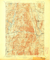
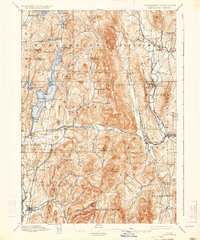
1897 Map of Castleton
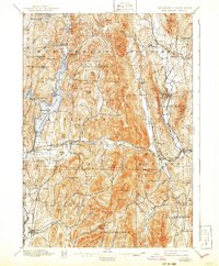
USGS Topo · Published 1948About this map
Lake Bomoseen dominates the western half of this Rutland County landscape, its waters punctuated by Rabbit Id. and Neshobee Id. near the lakeside settlement of Bomoseen. In the late 19th century, the region was a bustling corridor of industry and transit, defined by a complex network of rail lines including the Rutland R.R. and the Clarendon and Pittsford R.R.. These tracks served vital marble and slate centers like Proctor and West Rutland, connecting them to smaller outposts such as Florence and Hydeville.
Find a feature on this map
102 named features on this map. Tap any name to fly to it.
Don’t see what you’re looking for? This feature index may not catch every label — zoom into the map to look around manually.
Map Details
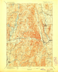
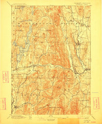
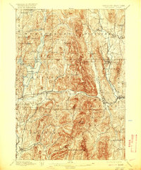
Editions of this 1897 Castleton Map
9 editions found


Other maps of this area

1891 · Rutland
USGS Topo · 1:62,500

1893 · Wallingford
USGS Topo · 1:62,500

1893 · Rutland
USGS Topo · 1:62,500

1893 · Fort Ann
USGS Topo · 1:62,500

1893 · Whitehall
USGS Topo · 1:62,500

1894 · Ticonderoga
USGS Topo · 1:62,500

1894 · Pawlet
USGS Topo · 1:62,500

1895 · Whitehall
USGS Topo · 1:62,500

1895 · Fort Ann
USGS Topo · 1:62,500

1895 · Castleton
USGS Topo · 1:62,500