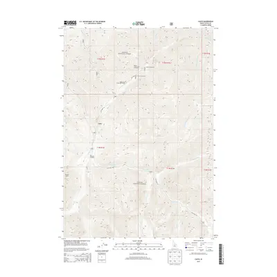
2013 Map of Casto
USGS Topo · Published 2013About this map
Loon Cr and its numerous tributaries dominate this high-elevation landscape within the Challis National Forest in Custer County. In 2013, the region remained primarily defined by its drainage basins and isolated outposts like Casto and Boyle Ranch. The map reveals a specialized infrastructure suited for backcountry access, notably the Upper Loon Creek USFS Airport and several remote campsites including Tincup Campground and the Phillips Creek Transfer Campground. Transportation is restricted to the winding Loon Creek Rd, which tracks the water through narrow valleys such as Packer Gulch. The dense network of named streams, from Salt Cr to Mayfield Cr, reflects a landscape where water and topography dictate the limited human footprint of forest service operations and private ranching.
Find a feature on this map
35 named features on this map. Tap any name to fly to it.
Don’t see what you’re looking for? This feature index may not catch every label — zoom into the map to look around manually.
Map Details
Editions of this 2013 Casto Map
This is the sole edition of this map. No revisions or reprints were ever made.
Other maps of this area

1919 · Custer
USGS Topo · 1:125,000

1922 · Custer
USGS Topo · 1:125,000

1930 · Casto
USGS Topo · 1:125,000

1957 · Challis
USGS Topo · 1:250,000

1960 · Challis
USGS Topo · 1:250,000

1963 · Challis
USGS Topo · 1:250,000

1963 · Pinyon Peak
USGS Topo · 1:24,000

1963 · Custer
USGS Topo · 1:24,000

1963 · Casto
USGS Topo · 1:24,000

1963 · Rock Creek
USGS Topo · 1:24,000