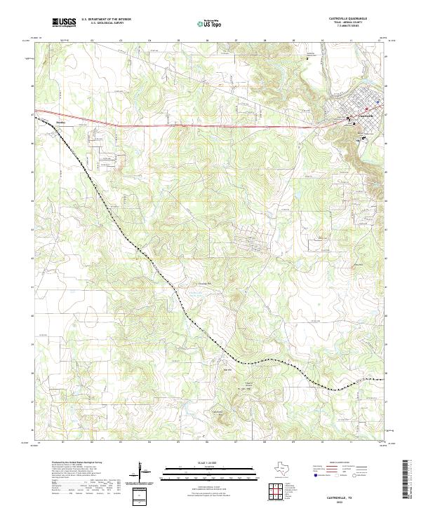
2022 Map of Castroville
USGS Topo · Published 2022About this map
Castroville and its surrounding landscape are defined by the winding course of the Medina River and a complex network of historic burial grounds. The settlement patterns here reflect deep-rooted local heritage, evidenced by numerous small graveyards such as the DeMontel Family Cem, Renken Cem, and Ihnken Cem. The town itself is notably structured with streets named after European capitals—Vienna St, Berlin St, and Madrid St—suggesting the unique immigrant origins of this community.
Find a feature on this map
99 named features on this map. Tap any name to fly to it.
Don’t see what you’re looking for? This feature index may not catch every label — zoom into the map to look around manually.
Map Details
Editions of this 2022 Castroville Map
This is the sole edition of this map. No revisions or reprints were ever made.
Other maps of this area

1942 · Natalia
USGS Topo · 1:62,500

1954 · San Antonio
USGS Topo · 1:250,000

1956 · New Fountain
USGS Topo · 1:62,500

1957 · San Antonio
USGS Topo · 1:250,000

1958 · La Coste
USGS Topo · 1:24,000

1958 · La Coste NE
USGS Topo · 1:24,000

1964 · Riomedina
USGS Topo · 1:24,000

1964 · Castroville
USGS Topo · 1:24,000

1964 · Devine
USGS Topo · 1:24,000
1964 · Lytle
USGS Topo · 1:24,000