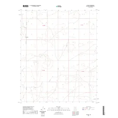
2023 Map of Cat Mesa
USGS Topo · Published 2023About this map
Cat Mesa dominates this high-altitude landscape in Socorro County, where the terrain is marked by the drainage of Dulce Draw. The map reveals a specialized infrastructure suited for the expansive cattle ranching and government operations typical of this region. The Monte Prieto Ranch Airport serves as a remote aviation landmark in the northwest corner, positioned just off Monte Prieto Rd. A network of rural corridors, including Co Rd 187 and Co Rd 190, weave through the township and range grids, providing access across this arid environment. The presence of Wsmr P Route 41 indicates the proximity to significant military or research restricted areas, characteristic of the central New Mexico desert. This survey provides an essential record of modern land use and remote transportation nodes in a sparsely populated section of the state.
Find a feature on this map
11 named features on this map. Tap any name to fly to it.
Don’t see what you’re looking for? This feature index may not catch every label — zoom into the map to look around manually.
Map Details
Editions of this 2023 Cat Mesa Map
This is the sole edition of this map. No revisions or reprints were ever made.
Other maps of this area

1918 · Oscura Peak
USGS Topo · 1:125,000

1948 · Broken Back Crater
USGS Topo · 1:62,500

1950 · Little Black Peak
USGS Topo · 1:62,500

1954 · Tularosa
USGS Topo · 1:250,000

1954 · Fort Sumner
USGS Topo · 1:250,000

1954 · Socorro
USGS Topo · 1:250,000

1955 · Roswell
USGS Topo · 1:250,000

1958 · Socorro
USGS Topo · 1:250,000

1958 · Fort Sumner
USGS Topo · 1:250,000

1958 · Roswell
USGS Topo · 1:250,000