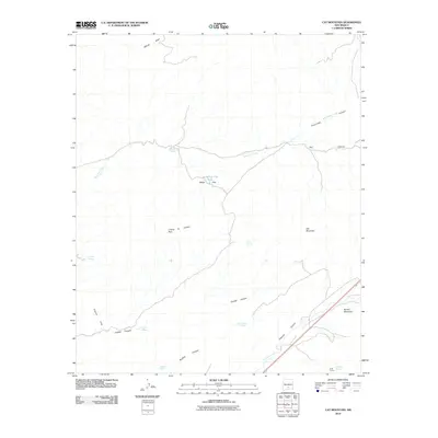
2010 Map of Cat Mountain
USGS Topo · Published 2010About this map
Cat Mountain and the high desert terrain of Otero County define this landscape at the edge of the Mescalero reservation. The map centers on a series of drainage networks and ephemeral water sources that were vital for cattle ranching in the region, including White Flat Tank and Aguilar Spring. The southern portion of the quadrangle is bisected by US Route 70, following the path of Tularosa Creek through a corridor between Round Mountain and the Coyote Hills. A network of canyons, most notably Tecolote Canyon and Rinconada Canyon, demonstrate the complex erosion patterns from the surrounding peaks. To the southeast, the site of Buck Camp sits near Apodaca Spring, marking a point of human activity within this arid environment where water sources like Maxwell Spring and Baca Spring provided the only reliable moisture for miles.
Find a feature on this map
25 named features on this map. Tap any name to fly to it.
Don’t see what you’re looking for? This feature index may not catch every label — zoom into the map to look around manually.
Map Details
Editions of this 2010 Cat Mountain Map
This is the sole edition of this map. No revisions or reprints were ever made.
Other maps of this area

1916 · Tularosa
USGS Topo · 1:125,000

1947 · Three Rivers
USGS Topo · 1:62,500

1948 · Tularosa
USGS Topo · 1:62,500

1950 · Three Rivers
USGS Topo · 1:24,000

1950 · Sierra Blanca Peak
USGS Topo · 1:62,500

1950 · Mescalero
USGS Topo · 1:62,500

1954 · Tularosa
USGS Topo · 1:250,000

1955 · Roswell
USGS Topo · 1:250,000

1958 · Roswell
USGS Topo · 1:250,000

1958 · Tularosa
USGS Topo · 1:250,000