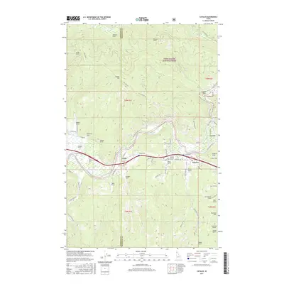
2017 Map of Cataldo
USGS Topo · Published 2017About this map
The Coeur d'Alene River defines the landscape of this Kootenai and Shoshone County border region, carving a path through the northern Bitterroot Range foothills. This 2017 survey details the historic river valley settlements of Cataldo, Kingston, and Enaville, where the river splits into its main and south forks. Significant cultural landmarks include the Old Mission Cem at Mission Flats and the Shoshone Memorial Gardens, reflecting the deep-rooted history of the area. The terrain is marked by numerous family-named gulches and draws such as Hayden Gulch, Whiteman Draw, and French Gulch, which suggest a legacy of local homesteading and resource extraction. High points like Cataldo Mtn and Fubar Peak overlook the valley corridors, while the boundaries of the Coeur d'Alene National Forest cover the steep, wooded ridges rising from the riverbanks.
Find a feature on this map
68 named features on this map. Tap any name to fly to it.
Don’t see what you’re looking for? This feature index may not catch every label — zoom into the map to look around manually.
Map Details
Editions of this 2017 Cataldo Map
This is the sole edition of this map. No revisions or reprints were ever made.
Other maps of this area

1909 · Cataldo
USGS Topo · 1:125,000

1911 · Cataldo
USGS Topo · 1:125,000

1950 · Rochat Peak
USGS Topo · 1:24,000

1950 · Twin Crags
USGS Topo · 1:24,000

1952 · Rochat Peak
USGS Topo · 1:24,000

1952 · Twin Crags
USGS Topo · 1:24,000

1955 · Spokane
USGS Topo · 1:250,000

1957 · Kingston
USGS Topo · 1:62,500

1957 · Kellogg
USGS Topo · 1:62,500

1957 · Calder
USGS Topo · 1:62,500