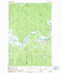
1985 Map of Cataldo
USGS Topo · Published 1985About this map
Old Mission State Park (Sacred Heart) stands as a focal point of this mid-1980s survey, marking a site of deep historical significance near the Coeur d'Alene River in Idaho. The settlement of Cataldo is situated along the river valley, flanked by the broad Mission Flats and the rising slopes of Cataldo Mtn. Further east, the community of Kingston serves as another primary landmark, nestled where the river begins to wind through the forest.
Find a feature on this map
34 named features on this map. Tap any name to fly to it.
Don’t see what you’re looking for? This feature index may not catch every label — zoom into the map to look around manually.
Map Details
Editions of this 1985 Cataldo Map
This is the sole edition of this map. No revisions or reprints were ever made.
Other maps of this area

1909 · Cataldo
USGS Topo · 1:125,000

1911 · Cataldo
USGS Topo · 1:125,000

1950 · Rochat Peak
USGS Topo · 1:24,000

1950 · Twin Crags
USGS Topo · 1:24,000

1952 · Rochat Peak
USGS Topo · 1:24,000

1952 · Twin Crags
USGS Topo · 1:24,000

1955 · Spokane
USGS Topo · 1:250,000

1957 · Kingston
USGS Topo · 1:62,500

1957 · Kellogg
USGS Topo · 1:62,500

1957 · Calder
USGS Topo · 1:62,500