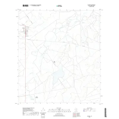
2019 Map of Catarina
USGS Topo · Published 2019About this map
Catarina stands as the primary settlement in this Dimmit County landscape, with its residential grid structured around streets like Guadalupe Ave, Isabela Ave, and San Mateo Ave. This region of south Texas is defined by its ranching infrastructure and intermittent water sources, characterized by the winding path of San Roque Cr and several managed water bodies including San Roque Lake and the numerically designated Light Lake Number 1 and Light Lake Number 2. The transportation network is built for ranch access, featuring Diamond H Rch Rd and Ranch Rd 133. Aviation plays a notable role in the local economy, evidenced by the presence of Briggs Ranch Airport and the Harrison Piloncillo Ranch Airport, which serve the expansive private holdings south of the town center near Harrison Lake Number 4.
Find a feature on this map
20 named features on this map. Tap any name to fly to it.
Don’t see what you’re looking for? This feature index may not catch every label — zoom into the map to look around manually.
Map Details
Editions of this 2019 Catarina Map
This is the sole edition of this map. No revisions or reprints were ever made.
Other maps of this area

1925 · San Roque Lake 1-a
USGS Topo · 1:48,000

1927 · Bart
USGS Topo · 1:62,500

1929 · Cotulla
USGS Topo · 1:125,000

1932 · Valley Wells
USGS Topo · 1:62,500

1940 · Velenzuela Creek
USGS Topo · 1:62,500

1940 · Catarina
USGS Topo · 1:62,500

1940 · Artesia Wells
USGS Topo · 1:62,500

1953 · Crystal City
USGS Topo · 1:250,000

1955 · Crystal City
USGS Topo · 1:250,000

1957 · Encinal
USGS Topo · 1:62,500