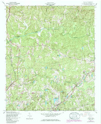
1955 Map of Cataula
USGS Topo · Published 1986About this map
Oak Mountain anchors the northeastern corner of this Harris County survey, while the Central of Georgia and Southern railroads dictate the development of the lowland corridors. The landscape is dotted with small-scale agricultural and community hubs such as Cataula, Ellerslie, and Waverly Hall. A high density of private and named lakes, including Lake Kutchaupee, Ganns Lake, and McGrills Lake, suggests a region defined by managed water and residential homesteading. Local social infrastructure is well-recorded through several country houses of worship, such as Flowers Ch and St Lukes Ch, and the Good Samaritan Home for Aged. The topographic detail reveals the intricate drainage patterns of Mulberry Creek and Ossahatchie Creek as they wind through the varied elevation of the Georgia Piedmont.
Find a feature on this map
44 named features on this map. Tap any name to fly to it.
Don’t see what you’re looking for? This feature index may not catch every label — zoom into the map to look around manually.
Map Details
Editions of this 1955 Cataula Map
3 editions found
Other maps of this area

1907 · Talbotton
USGS Topo · 1:125,000

1934 · Warm Springs
USGS Topo · 1:62,500

1936 · Warm Springs
USGS Topo · 1:62,500

1949 · Midland
USGS Topo · 1:24,000

1949 · Upatoi
USGS Topo · 1:24,000

1950 · Fortson
USGS Topo · 1:24,000

1950 · Mulberry Grove
USGS Topo · 1:24,000

1950 · Waverly Hall
USGS Topo · 1:24,000

1950 · Cataula
USGS Topo · 1:24,000

1950 · Talbotton
USGS Topo · 1:62,500