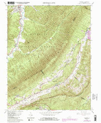
1963 Map of Catawba
USGS Topo · Published 1984About this map
McAfee Knob and the surrounding heights of North Mountain dominate this landscape, which is largely contained within the Jefferson National Forest. The map shows a region of Virginia where agricultural valleys and steep forested ridges create distinct corridors for settlement and travel. In the northern corner, the village of New Castle sits near Craig Creek, while the southern end features the Catawba Hospital complex and the community of Catawba. The Appalachian Trail follows the high ground of Tinker Mountain, passing over rocky peaks and providing access to the deep geological feature known as The Murder Hole. Local history is anchored by family landmarks like the Morgan Cem and rural congregations such as Mountain View Ch and New Hope Ch, reflecting the dispersed nature of these Appalachian communities.
Find a feature on this map
42 named features on this map. Tap any name to fly to it.
Don’t see what you’re looking for? This feature index may not catch every label — zoom into the map to look around manually.
Map Details
Editions of this 1963 Catawba Map
4 editions found
Other maps of this area

1887 · Lewisburg
USGS Topo · 1:125,000

1890 · Roanoke
USGS Topo · 1:125,000

1890 · Christiansburg
USGS Topo · 1:125,000

1891 · Roanoke
USGS Topo · 1:125,000

1891 · Lewisburg
USGS Topo · 1:125,000

1894 · Natural Bridge
USGS Topo · 1:125,000

1913 · Eagle Rock
USGS Topo · 1:48,000

1915 · Eagle Rock
USGS Topo · 1:62,500

1929 · Roanoke
USGS Topo · 1:48,000

1929 · Salem
USGS Topo · 1:48,000