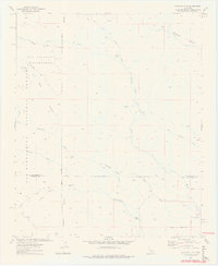
1972 Map of Catclaw Flat
USGS Topo · Published 1975About this map
The high desert canyons and mountains of the San Bernardino National Forest dominate this landscape, where the Whitewater River and its various forks carve through the terrain. The presence of Wathier Landing and the Stills Landing (Ruins) along the river suggests a history of remote riverside activity in an otherwise arduous environment. These points of interest sit near the San Bernardino and Riverside county line, where the topography shifts toward the open space of Catclaw Flat.
Find a feature on this map
28 named features on this map. Tap any name to fly to it.
Don’t see what you’re looking for? This feature index may not catch every label — zoom into the map to look around manually.
Map Details
Editions of this 1972 Catclaw Flat Map
4 editions found
Other maps of this area

1901 · Southern California Sheet No. 1
USGS Topo · 1:250,000

1901 · San Jacinto
USGS Topo · 1:125,000

1902 · San Gorgonio
USGS Topo · 1:125,000

1904 · Southern California Sheet No. 1
USGS Topo · 1:250,000

1940 · Palm Springs
USGS Topo · 1:62,500

1942 · Banning
USGS Topo · 1:62,500

1943 · Banning
USGS Topo · 1:62,500

1944 · Palm Springs
USGS Topo · 1:62,500

1947 · Santa Ana
USGS Topo · 1:250,000

1949 · Santa Ana
USGS Topo · 1:250,000