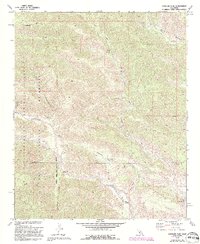
1972 Map of Catclaw Flat
USGS Topo · Published 1994About this map
Stills Landing (Ruins) and Wathier Landing mark the remote landscape of the San Bernardino Mountains as they appeared in the early 1970s. The terrain is defined by the sharp descent of the South Fork Whitewater River and the winding route of the Pacific Crest National Scenic Trail, which traverses the high ridges and canyons. The map captures a moment of preservation within the San Bernardino National Forest and the San Gorgonio Wilderness, illustrating how the land remained largely undeveloped except for 4WD tracks and the occasional Gaging Station.
Find a feature on this map
28 named features on this map. Tap any name to fly to it.
Don’t see what you’re looking for? This feature index may not catch every label — zoom into the map to look around manually.
Map Details
Editions of this 1972 Catclaw Flat Map
4 editions found
Other maps of this area

1901 · Southern California Sheet No. 1
USGS Topo · 1:250,000

1901 · San Jacinto
USGS Topo · 1:125,000

1902 · San Gorgonio
USGS Topo · 1:125,000

1904 · Southern California Sheet No. 1
USGS Topo · 1:250,000

1940 · Palm Springs
USGS Topo · 1:62,500

1942 · Banning
USGS Topo · 1:62,500

1943 · Banning
USGS Topo · 1:62,500

1944 · Palm Springs
USGS Topo · 1:62,500

1947 · Santa Ana
USGS Topo · 1:250,000

1949 · Santa Ana
USGS Topo · 1:250,000