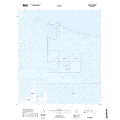
2020 Map of Catfish Lake
USGS Topo · Published 2020About this map
Catfish Lake and the surrounding marshlands of Cameron Parish define this coastal landscape, where the Mermentau River winds through complex waterways toward Grand Lake. The terrain is characterized by slightly elevated ridges and islands that provide the only firm ground amidst the wetlands, notably Little Pecan Island and Elm Island. These landforms dictate the footprint of human activity, as seen with the Little Pecan Island Airport and the road along Hackberry Ridge at the southern edge of the survey.
Find a feature on this map
25 named features on this map. Tap any name to fly to it.
Don’t see what you’re looking for? This feature index may not catch every label — zoom into the map to look around manually.
Map Details
Editions of this 2020 Catfish Lake Map
This is the sole edition of this map. No revisions or reprints were ever made.
Other maps of this area

1932 · Constance Bayou NW
USGS Topo · 1:31,680

1934 · Catfish Lake
USGS Topo · 1:24,000

1934 · Lake Misere
USGS Topo · 1:24,000

1934 · Latania Lake
USGS Topo · 1:24,000

1935 · Lake Misere
USGS Topo · 1:31,680

1935 · Catfish Lake
USGS Topo · 1:31,680

1935 · Latania Lake
USGS Topo · 1:31,680

1935 · Grand Chenier
USGS Topo · 1:31,680

1946 · Hog Bayou NE
USGS Topo · 1:31,680

1946 · Hog Bayou NW
USGS Topo · 1:31,680