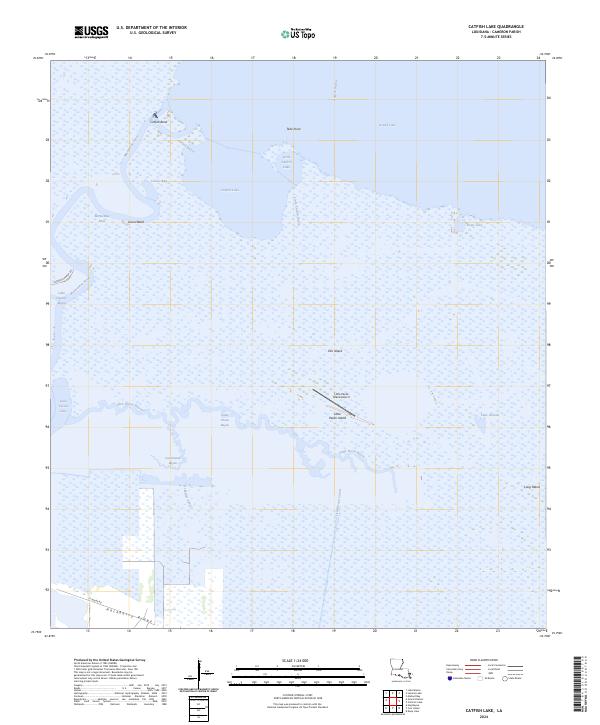
2024 Map of Catfish Lake
USGS Topo · Published 2024About this map
Mermentau River winds through the wetlands of southern Cameron Parish, defining a landscape of complex hydrology where the river meets Catfish Lake and Grand Lake. This coastal environment is characterized by its intricate network of waterways, including Catfish Bayou and the man-made Dr Miller Canal. Dry ground is found on isolated rises such as Elm Island and Little Pecan Island, the latter of which features the Little Pecan Island Airport, reflecting the necessity of air travel in this water-bound region.
Find a feature on this map
28 named features on this map. Tap any name to fly to it.
Don’t see what you’re looking for? This feature index may not catch every label — zoom into the map to look around manually.
Map Details
Editions of this 2024 Catfish Lake Map
This is the sole edition of this map. No revisions or reprints were ever made.
Other maps of this area

1932 · Constance Bayou NW
USGS Topo · 1:31,680

1934 · Catfish Lake
USGS Topo · 1:24,000

1934 · Lake Misere
USGS Topo · 1:24,000

1934 · Latania Lake
USGS Topo · 1:24,000

1935 · Lake Misere
USGS Topo · 1:31,680

1935 · Catfish Lake
USGS Topo · 1:31,680

1935 · Latania Lake
USGS Topo · 1:31,680

1935 · Grand Chenier
USGS Topo · 1:31,680

1946 · Hog Bayou NE
USGS Topo · 1:31,680

1946 · Hog Bayou NW
USGS Topo · 1:31,680