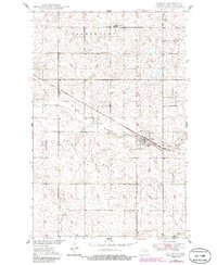
1949 Map of Cathay
USGS Topo · Published 1986About this map
The prairie landscape of Wells County is defined by the diagonal transit of the Soo Line railroad, which anchors the small community of Cathay. This survey, compiled from 1940s aerial photography and later field-checked, reveals a rural grid system organized into townships including Germantown, Fairview, and Cathay. The drainage of Rocky Run meanders toward the southeast, cutting through the section lines and connecting the town to the surrounding agricultural plains. Local infrastructure for this mid-century period is well-preserved here, showing the locations of School No 3 north of town and the Lake View Cem nearby. Further south, the map captures the upper reaches of the Pipestem drainage and several Gravel Pit operations that supported local road building and maintenance.
Find a feature on this map
12 named features on this map. Tap any name to fly to it.
Don’t see what you’re looking for? This feature index may not catch every label — zoom into the map to look around manually.
Map Details
Editions of this 1949 Cathay Map
2 editions found
Other maps of this area

1948 · Cathay
USGS Topo · 1:62,500

1948 · Fessenden
USGS Topo · 1:62,500

1948 · Bremen
USGS Topo · 1:24,000

1949 · Bremen
USGS Topo · 1:24,000

1949 · Cathay
USGS Topo · 1:24,000

1949 · Cathay SE
USGS Topo · 1:24,000

1949 · Fessenden East
USGS Topo · 1:24,000

1949 · Munster
USGS Topo · 1:24,000

1949 · Emrick
USGS Topo · 1:24,000

1951 · Heaton
USGS Topo · 1:24,000