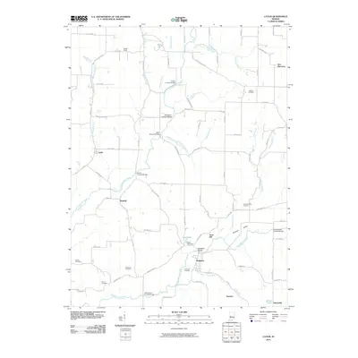
2010 Map of Catlin
USGS Topo · Published 2010About this map
Big Raccoon Creek and its many tributaries, including Little Raccoon Creek, define the landscape of this Parke County region. The area is exceptionally notable for its collection of river crossings, featuring several historic-style structures such as the Crooks Covered Bridge, McAllisters Covered Bridge, and the Nevins Covered Bridge. These bridges indicate a long-standing commitment to maintaining traditional transportation routes over the winding waterways. The settlement of Bridgeton serves as a local hub near the Bridgeton Bridge and the Aitken Lake Dam, while smaller locales like Catlin, Minshall, and Superior dot the surrounding countryside. Genealogists will find a wealth of records in the numerous burial grounds scattered across the terrain, from the Hatfield Cemetery in the north to the Adams Cemetery and Brunot Cemetery further south, each marking the legacy of the area's early families.
Find a feature on this map
78 named features on this map. Tap any name to fly to it.
Don’t see what you’re looking for? This feature index may not catch every label — zoom into the map to look around manually.
Map Details
Editions of this 2010 Catlin Map
This is the sole edition of this map. No revisions or reprints were ever made.
Other maps of this area

1950 · Rosedale
USGS Topo · 1:24,000

1950 · Brazil East
USGS Topo · 1:24,000

1950 · Brazil West
USGS Topo · 1:24,000

1951 · Mecca
USGS Topo · 1:24,000

1951 · Mansfield
USGS Topo · 1:24,000

1952 · Catlin
USGS Topo · 1:24,000

1953 · Indianapolis
USGS Topo · 1:250,000

1955 · Rockville
USGS Topo · 1:24,000

1955 · Montezuma
USGS Topo · 1:24,000

1956 · Indianapolis
USGS Topo · 1:250,000