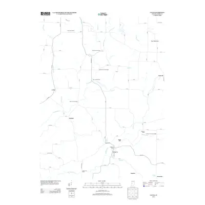
2013 Map of Catlin
USGS Topo · Published 2013About this map
Crooks Covered Bridge and McAllisters Covered Bridge span the waterways of Parke County, highlighting a landscape defined by its historical stream crossings. This 2013 survey records the rural character of the region, where small settlements like Minshall and New Discovery are linked by a network of county roads. The drainage of Little Raccoon Cr and its tributaries, including Leatherwood Br and Lakeys Br, dictates the placement of these distinctive engineering landmarks. Further south, the map details the community of Bridgeton, situated near the Bridgeton Bridge and Case Lake. The terrain is generally low-lying, punctuated by Snow Hill and the winding course of Big Raccoon Cr, which flows past Pleasant Valley and the Conleys Ford Covered Bridge. This modern topographic study preserves the spatial relationship between local aviation at Butler Field Airport and the enduring small-town footprints of Piattsville and Catlin.
Find a feature on this map
79 named features on this map. Tap any name to fly to it.
Don’t see what you’re looking for? This feature index may not catch every label — zoom into the map to look around manually.
Map Details
Editions of this 2013 Catlin Map
This is the sole edition of this map. No revisions or reprints were ever made.
Other maps of this area

1950 · Rosedale
USGS Topo · 1:24,000

1950 · Brazil East
USGS Topo · 1:24,000

1950 · Brazil West
USGS Topo · 1:24,000

1951 · Mecca
USGS Topo · 1:24,000

1951 · Mansfield
USGS Topo · 1:24,000

1952 · Catlin
USGS Topo · 1:24,000

1953 · Indianapolis
USGS Topo · 1:250,000

1955 · Rockville
USGS Topo · 1:24,000

1955 · Montezuma
USGS Topo · 1:24,000

1956 · Indianapolis
USGS Topo · 1:250,000