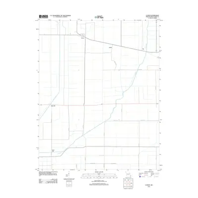
2012 Map of Catron
USGS Topo · Published 2012About this map
Catron serves as a focal point for this agrarian landscape in New Madrid County, situated at a junction where local commerce and transit met during the early 21st century. The map reveals an intricate network of drainage systems essential to this region's fertile plains, including the prominent Little River and Main Ditch. These man-made and natural waterways highlight the long history of land reclamation and water management required to support the local agricultural economy. Small named settlements like Dodds and Sky punctuate the landscape along a grid of county roads, while Baderville and Lone Star anchor the southern reaches of the quadrangle. The presence of Church St in Catron and named thoroughfares such as Edgewater Rd speak to a community defined by its proximity to these vital water routes and the disciplined layout of its rural infrastructure.
Find a feature on this map
24 named features on this map. Tap any name to fly to it.
Don’t see what you’re looking for? This feature index may not catch every label — zoom into the map to look around manually.
Map Details
Editions of this 2012 Catron Map
This is the sole edition of this map. No revisions or reprints were ever made.
Other maps of this area

1939 · Portageville
USGS Topo · 1:62,500

1939 · New Madrid
USGS Topo · 1:62,500

1940 · Malden
USGS Topo · 1:62,500

1940 · Pascola
USGS Topo · 1:62,500

1951 · New Madrid SE
USGS Topo · 1:24,000

1954 · New Madrid
USGS Topo · 1:62,500

1955 · Pascola
USGS Topo · 1:62,500

1955 · Portageville
USGS Topo · 1:62,500

1956 · Malden
USGS Topo · 1:62,500

1956 · Dyersburg
USGS Topo · 1:250,000