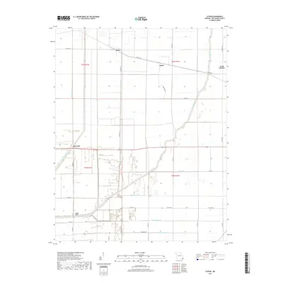
2017 Map of Catron
USGS Topo · Published 2017About this map
Catron and North Lilbourn anchor this New Madrid County landscape, defined by an intensive network of drainage engineering and agriculture in the Missouri Bootheel. The map reveals the intricate management of the Mississippi alluvial plain, where the Little River is supplemented by artificial channels like Main Ditch and Ditch Number 40. These features were essential for reclaiming and maintaining the fertile soils that support the region's farming economy.
Find a feature on this map
33 named features on this map. Tap any name to fly to it.
Don’t see what you’re looking for? This feature index may not catch every label — zoom into the map to look around manually.
Map Details
Editions of this 2017 Catron Map
This is the sole edition of this map. No revisions or reprints were ever made.
Other maps of this area

1939 · Portageville
USGS Topo · 1:62,500

1939 · New Madrid
USGS Topo · 1:62,500

1940 · Malden
USGS Topo · 1:62,500

1940 · Pascola
USGS Topo · 1:62,500

1951 · New Madrid SE
USGS Topo · 1:24,000

1954 · New Madrid
USGS Topo · 1:62,500

1955 · Pascola
USGS Topo · 1:62,500

1955 · Portageville
USGS Topo · 1:62,500

1956 · Malden
USGS Topo · 1:62,500

1956 · Dyersburg
USGS Topo · 1:250,000