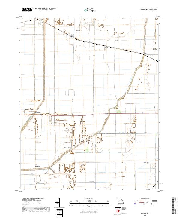
2021 Map of Catron
USGS Topo · Published 2021About this map
Catron and the surrounding agricultural lowlands of New Madrid County are defined by an extensive engineered drainage network designed to manage the Mississippi River floodplain. This landscape is a grid of section lines and water management features, including the substantial Main Ditch and the winding course of the Little River. Small rural clusters such as Dodds and Baderville are linked by a system of state highways and county roads like State Hwy D and Edgewater Rd.
Find a feature on this map
30 named features on this map. Tap any name to fly to it.
Don’t see what you’re looking for? This feature index may not catch every label — zoom into the map to look around manually.
Map Details
Editions of this 2021 Catron Map
This is the sole edition of this map. No revisions or reprints were ever made.
Other maps of this area

1939 · Portageville
USGS Topo · 1:62,500

1939 · New Madrid
USGS Topo · 1:62,500

1940 · Malden
USGS Topo · 1:62,500

1940 · Pascola
USGS Topo · 1:62,500

1951 · New Madrid SE
USGS Topo · 1:24,000

1954 · New Madrid
USGS Topo · 1:62,500

1955 · Pascola
USGS Topo · 1:62,500

1955 · Portageville
USGS Topo · 1:62,500

1956 · Malden
USGS Topo · 1:62,500

1956 · Dyersburg
USGS Topo · 1:250,000