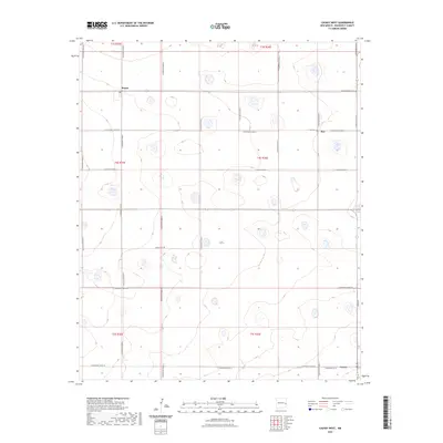
2023 Map of Causey West
USGS Topo · Published 2023About this map
Rogers and Inez sit along a stark agricultural landscape in Roosevelt County, defined by a rigid grid of section lines and gravel roads. This contemporary survey by the U.S. Geological Survey reflects the enduring rural structure of the High Plains, where small communities and family burial grounds remain the primary landmarks. Genealogical researchers will find the locations of Inez Cem and Longs Cem particularly useful for identifying family plots in this sparsely populated region. The transition from the northern reaches near Rogers down toward Causey in the southeast is connected by thoroughfares like New-Mexico-235 and Main St, while several depressions and wetlands interrupt the otherwise uniform township blocks of t4s r36e and surrounding ranges.
Find a feature on this map
27 named features on this map. Tap any name to fly to it.
Don’t see what you’re looking for? This feature index may not catch every label — zoom into the map to look around manually.
Map Details
Editions of this 2023 Causey West Map
This is the sole edition of this map. No revisions or reprints were ever made.
Other maps of this area

1954 · Clovis
USGS Topo · 1:250,000

1954 · Brownfield
USGS Topo · 1:250,000

1957 · Arch
USGS Topo · 1:62,500

1957 · Portales
USGS Topo · 1:62,500

1958 · Brownfield
USGS Topo · 1:250,000

1958 · Clovis
USGS Topo · 1:250,000

1962 · Brownfield
USGS Topo · 1:250,000

1970 · Lingo
USGS Topo · 1:24,000

1970 · Causey East
USGS Topo · 1:24,000

1972 · Garrison
USGS Topo · 1:24,000