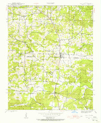
1943 Map of Cave City
USGS Topo · Published 1956About this map
Cave City sits at the heart of this mid-century survey, positioned along the border where Sharp and Independence Counties meet. This era in north-central Arkansas is defined by a network of rural schools and congregations that served as the social backbone for dispersed farming families. The landscape is marked by landmarks such as Maxville Church and Maxville School in the north, while Hickory Valley and Grays Chapel anchor the southern reaches. Numerous named hills like Smith Hill and Wilmutt Hill break up the terrain between the headwaters of Curia Creek and Dota Creek. This record captures the transition from isolated rural life to a more connected community, evidenced by the established Cave City Cemetery and the convergence of local routes like the Sidney Road.
Find a feature on this map
49 named features on this map. Tap any name to fly to it.
Don’t see what you’re looking for? This feature index may not catch every label — zoom into the map to look around manually.
Map Details
Editions of this 1943 Cave City Map
5 editions found
Other maps of this area

1890 · Batesville
USGS Topo · 1:125,000

1891 · Batesville
USGS Topo · 1:125,000

1932 · Strawberry
USGS Topo · 1:62,500

1935 · Strawberry
USGS Topo · 1:62,500

1941 · Strawberry
USGS Topo · 1:62,500

1942 · Batesville
USGS Topo · 1:31,680

1943 · Sandtown
USGS Topo · 1:24,000

1943 · Cave City
USGS Topo · 1:31,680

1943 · Sulphur Rock
USGS Topo · 1:31,680

1943 · Batesville
USGS Topo · 1:24,000