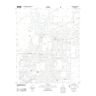
2011 Map of Cave Creek
USGS Topo · Published 2011About this map
Cave Creek and Carefree are established as the primary residential and commercial hubs in this Sonoran Desert landscape as it appeared in the early twenty-first century. The map illustrates a transitional period of suburban development, where planned communities such as Dove Valley Ranch, Desert Wind, and Sincuidados expand into the desert terrain surrounding Black Mountain. This era is marked by the integration of recreation and high-end residential life, evidenced by the Desert Mountain Golf Course and the Boulders Golf Course. Cultural and logistical infrastructure is well-defined, ranging from the Heard Museum North and Desert Foothills Amphitheater to the Sky Ranch Carefree Airport. Local history is anchored by the Cave Creek Cemetery and the prominent drainages of Willow Springs Wash and Galloway Wash, which have long shaped the region's topography.
Find a feature on this map
66 named features on this map. Tap any name to fly to it.
Don’t see what you’re looking for? This feature index may not catch every label — zoom into the map to look around manually.
Map Details
Editions of this 2011 Cave Creek Map
This is the sole edition of this map. No revisions or reprints were ever made.
Other maps of this area

1904 · Camelback
USGS Topo · 1:62,500

1906 · Camelsback
USGS Topo · 1:62,500

1930 · Cave Creek
USGS Topo · 1:125,000

1939 · Cave Creek
USGS Topo · 1:125,000

1954 · Phoenix
USGS Topo · 1:250,000

1954 · Mesa
USGS Topo · 1:250,000

1957 · Mesa
USGS Topo · 1:250,000

1957 · Phoenix
USGS Topo · 1:250,000

1958 · Mesa
USGS Topo · 1:250,000

1958 · Phoenix
USGS Topo · 1:250,000