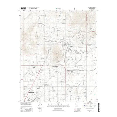
2014 Map of Cave Creek
USGS Topo · Published 2014About this map
Cave Creek and Carefree sit at the northern edge of the desert valley, where residential expansion meets the foothills of the Tonto National Forest. The landscape is defined by its drainage systems, including the namesake Cave Creek and the meandering Galloway Wash, which cut through a terrain of prominent peaks like Black Mtn and Go John Mtn. This 2014 survey captures a period of significant development, showing established neighborhoods such as Dove Valley Ranch and Carefree Foothills integrated into the alluvial fan topography. Smaller landmarks like Grapevine Spring and several named cattle tanks, such as Charlie Tank and Rock Tank, reflect the area's transition from a ranching past toward a modern suburban identity. Local history is anchored at the Cave Creek Cem, while the northern reaches of Phoenix and Scottsdale begin to converge in the southern portions of the quadrangle.
Find a feature on this map
234 named features on this map. Tap any name to fly to it.
Don’t see what you’re looking for? This feature index may not catch every label — zoom into the map to look around manually.
Map Details
Editions of this 2014 Cave Creek Map
This is the sole edition of this map. No revisions or reprints were ever made.
Other maps of this area

1904 · Camelback
USGS Topo · 1:62,500

1906 · Camelsback
USGS Topo · 1:62,500

1930 · Cave Creek
USGS Topo · 1:125,000

1939 · Cave Creek
USGS Topo · 1:125,000

1954 · Phoenix
USGS Topo · 1:250,000

1954 · Mesa
USGS Topo · 1:250,000

1957 · Mesa
USGS Topo · 1:250,000

1957 · Phoenix
USGS Topo · 1:250,000

1958 · Mesa
USGS Topo · 1:250,000

1958 · Phoenix
USGS Topo · 1:250,000