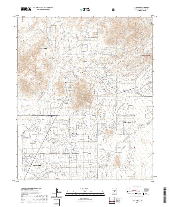
2021 Map of Cave Creek
USGS Topo · Published 2021About this map
Cave Creek and Carefree sit at the northern edge of the Valley of the Sun, where desert residential expansion meets the high-relief terrain of the Tonto National Forest. The map documents a modern landscape of planned communities and suburban integration into the Sonoran foothills, with the municipal boundaries of Scottsdale and Phoenix encroaching from the south. High-desert landmarks like Black Mountain and Go John Mountain rise above a complex network of seasonal drainages, including Galloway Wash and Willow Springs Wash. Aviation history is represented by the Sky Ranch at Carefree Airport, while local heritage is anchored at the Cave Creek Cem. The transition from urban grids to winding mountain roads like E Continental Mountain Dr illustrates the mid-to-late 20th-century development patterns of these resort and residential communities.
Find a feature on this map
137 named features on this map. Tap any name to fly to it.
Don’t see what you’re looking for? This feature index may not catch every label — zoom into the map to look around manually.
Map Details
Editions of this 2021 Cave Creek Map
This is the sole edition of this map. No revisions or reprints were ever made.
Other maps of this area

1904 · Camelback
USGS Topo · 1:62,500

1906 · Camelsback
USGS Topo · 1:62,500

1930 · Cave Creek
USGS Topo · 1:125,000

1939 · Cave Creek
USGS Topo · 1:125,000

1954 · Phoenix
USGS Topo · 1:250,000

1954 · Mesa
USGS Topo · 1:250,000

1957 · Mesa
USGS Topo · 1:250,000

1957 · Phoenix
USGS Topo · 1:250,000

1958 · Mesa
USGS Topo · 1:250,000

1958 · Phoenix
USGS Topo · 1:250,000