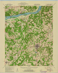
1958 Map of Cave In Rock
USGS Topo · Published 1960About this map
Marion serves as the focal point of this late 1950s survey, situated at the junction of several regional routes including Kentucky 91 and Kentucky 120. To the north, the Ohio River forms a natural boundary between Kentucky and Illinois, facilitated by the Cave in Rock Ferry and Fords Ferry. This river corridor was a critical transit point, evidenced by Dam No 50 and the riverside settlement of Tolu. The landscape is dotted with numerous small-scale institutions like Freedom Ch and Crittenden Spring Sch, reflecting a dispersed rural community structure.
Find a feature on this map
120 named features on this map. Tap any name to fly to it.
Don’t see what you’re looking for? This feature index may not catch every label — zoom into the map to look around manually.
Map Details
Editions of this 1958 Cave In Rock Map
This is the sole edition of this map. No revisions or reprints were ever made.
Other maps of this area

1907 · Morganfield
USGS Topo · 1:62,500

1908 · Princeton
USGS Topo · 1:62,500

1909 · Providence
USGS Topo · 1:62,500

1910 · Princeton
USGS Topo · 1:62,500

1916 · Shawneetown
USGS Topo · 1:62,500

1916 · Fords Ferry
USGS Topo · 1:62,500

1916 · Golconda
USGS Topo · 1:62,500

1916 · Equality
USGS Topo · 1:62,500

1920 · Goloonda
USGS Topo · 1:48,000

1921 · Fords Ferry
USGS Topo · 1:48,000