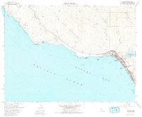
1965 Map of Cayucos
USGS Topo · Published 1980About this map
Estero Bay and the Central California coastline define this mid-1960s survey, dominated by the emerging community of Cayucos. The map documents the coastal landscape before modern expansion, highlighting the northern edge of the Morro Strand and the recreational stretch of Cayucos State Beach. Inland, the recently completed Whale Rock Reservoir stands as a significant hydrological marker near the Cayucos-Morro Bay District Cem, indicating the infrastructure shifts of the mid-20th century.
Find a feature on this map
35 named features on this map. Tap any name to fly to it.
Don’t see what you’re looking for? This feature index may not catch every label — zoom into the map to look around manually.
Map Details
Editions of this 1965 Cayucos Map
3 editions found
Other maps of this area

1897 · Cayucos
USGS Topo · 1:62,500

1900 · San Luis
USGS Topo · 1:125,000

1919 · Adelaida
USGS Topo · 1:62,500

1919 · San Simeon
USGS Topo · 1:62,500

1932 · Adelaida
USGS Topo · 1:62,500

1937 · Cayucos
USGS Topo · 1:62,500

1937 · San Simeon
USGS Topo · 1:62,500

1942 · Adelaida
USGS Topo · 1:62,500

1943 · Cayucos
USGS Topo · 1:62,500

1947 · San Luis Obispo
USGS Topo · 1:250,000