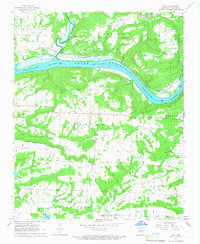
1965 Map of Cecil
USGS Topo · Published 1967About this map
The Arkansas River-Ozark Reservoir dominates the northern landscape of this mid-1960s survey, marking a period of significant hydraulic and industrial change in Franklin County. Just south of the river, the Cecil Gas Field and a network of pipelines illustrate the era's energy extraction, while numerous quarries dot the hillsides near the settlement of Cecil. The terrain shifts from the river bottomlands up to the distinctive height of Mill Creek Mountain, creating a varied environment for both industry and small rural communities.
Find a feature on this map
43 named features on this map. Tap any name to fly to it.
Don’t see what you’re looking for? This feature index may not catch every label — zoom into the map to look around manually.
Map Details
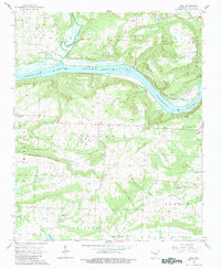
Editions of this 1965 Cecil Map
2 editions found
Other maps of this area

1879 · Cravens
USGS Topo · 1:62,500

1887 · Magazine Mountain #2
USGS Topo · 1:62,500

1887 · Watalula
USGS Topo · 1:62,500

1887 · Magazine Mountain
USGS Topo · 1:62,500

1890 · Magazine Mountain
USGS Topo · 1:125,000

1890 · Fort Smith
USGS Topo · 1:125,000

1898 · Winslow #4
USGS Topo · 1:62,500

1898 · Winslow
USGS Topo · 1:125,000

1901 · Winslow
USGS Topo · 1:125,000

1906 · Lavaca
USGS Topo · 1:62,500