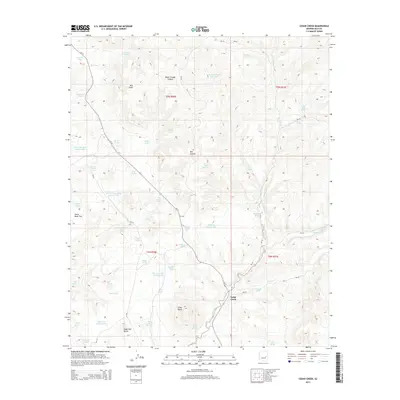
2014 Map of Cedar Creek
USGS Topo · Published 2014About this map
Cedar Creek serves as the primary landmark in this high-elevation landscape within Gila County, situated along the Az-73 corridor. The area is defined by a sophisticated network of livestock and wildlife water management features, including Two Bit Tank, Piggie Tank, and Heifer Tank, which are distributed among the drainages and flats. The topography is anchored by prominent rises such as Silver Butte, Sugarloaf Butte, and Red Knoll, which provided essential navigation points in the early 21st century. Numerous named springs, including Wigwam Spring, Stinking Spring, and Salt Springs, indicate the critical reliance on natural water sources in this arid environment. The road network, primarily composed of Bureau of Indian Affairs routes like Bia-30 and Bia-18, provides access to remote locations such as Horse Bone Flat and Water Trough Canyon, reflecting the land's ongoing use for grazing and transit.
Find a feature on this map
65 named features on this map. Tap any name to fly to it.
Don’t see what you’re looking for? This feature index may not catch every label — zoom into the map to look around manually.
Map Details
Editions of this 2014 Cedar Creek Map
This is the sole edition of this map. No revisions or reprints were ever made.
Other maps of this area

1886 · Holbrook
USGS Topo · 1:250,000

1893 · Holbrook
USGS Topo · 1:250,000

1954 · Holbrook
USGS Topo · 1:250,000

1954 · Mesa
USGS Topo · 1:250,000

1957 · Mesa
USGS Topo · 1:250,000

1957 · Holbrook
USGS Topo · 1:250,000

1958 · Mesa
USGS Topo · 1:250,000

1958 · Holbrook
USGS Topo · 1:250,000

1960 · Holbrook
USGS Topo · 1:250,000

1960 · Mesa
USGS Topo · 1:250,000