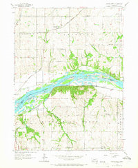
1956 Map of Cedar Creek
USGS Topo · Published 1966About this map
The Platte River carves a wide path through this mid-1950s landscape, serving as the natural boundary between Sarpy and Cass counties. The northern bank is defined by the Chicago Rock Island and Pacific railroad corridor, which connects the small settlement of Richfield to the surrounding prairie. On the southern bluffs, the Chicago Burlington and Quincy line runs parallel to the water, passing through Cullom and the village of Cedar Creek.
Find a feature on this map
27 named features on this map. Tap any name to fly to it.
Don’t see what you’re looking for? This feature index may not catch every label — zoom into the map to look around manually.
Map Details
Editions of this 1956 Cedar Creek Map
5 editions found

Other maps of this area

1893 · Fremont
USGS Topo · 1:125,000

1896 · Fremont
USGS Topo · 1:125,000

1903 · Weeping Water
USGS Topo · 1:125,000

1929 · Weeping Water
USGS Topo · 1:125,000

1935 · Nehawka
USGS Topo · 1:48,000

1940 · Nehawka
USGS Topo · 1:62,500

1954 · Omaha
USGS Topo · 1:250,000

1955 · Fremont
USGS Topo · 1:250,000

1955 · Nebraska City
USGS Topo · 1:250,000

1955 · Lincoln
USGS Topo · 1:250,000