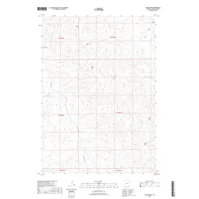
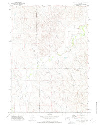
2017 Map of Cedar Draw
USGS Topo · Published 2017About this map
Raven Cr and its many tributary draws define the high plains drainage of Weston County, as shown in this 2017 U.S. Geological Survey topographic study. The landscape is characterized by a complex network of seasonal watercourses, including Cedar Draw, Butler Draw, and Buck Draw, which have carved deep paths through the terrain. A notable vertical landmark, Chalk Butte, rises in the southeastern portion of the quadrangle, serving as a distinct geographic reference point in this corner of Wyoming. Human activity is represented primarily by a sparse network of rural routes such as N Raven Creek Rd and Four Horse Rd, which follow the contours of the land. This map provides a detailed view of the modern ranching landscape, illustrating how property and access remain tied to the natural water-shedding features like Buffalo Cr and Alkali Draw.
Find a feature on this map
17 named features on this map. Tap any name to fly to it.
Don’t see what you’re looking for? This feature index may not catch every label — zoom into the map to look around manually.
Map Details
Editions of this 2017 Cedar Draw Map
This is the sole edition of this map. No revisions or reprints were ever made.
Other maps of this area
1918 · Moorcroft
USGS Topo · 1:125,000

1954 · Gillette
USGS Topo · 1:250,000

1955 · Newcastle
USGS Topo · 1:250,000

1955 · Gillette
USGS Topo · 1:250,000

1958 · Gillette
USGS Topo · 1:250,000

1958 · Newcastle
USGS Topo · 1:250,000

1962 · Gillette
USGS Topo · 1:250,000
1971 · Whitetail Creek SE
USGS Topo · 1:24,000
1971 · Jim Creek
USGS Topo · 1:24,000
1971 · Whitetail Creek NE
USGS Topo · 1:24,000