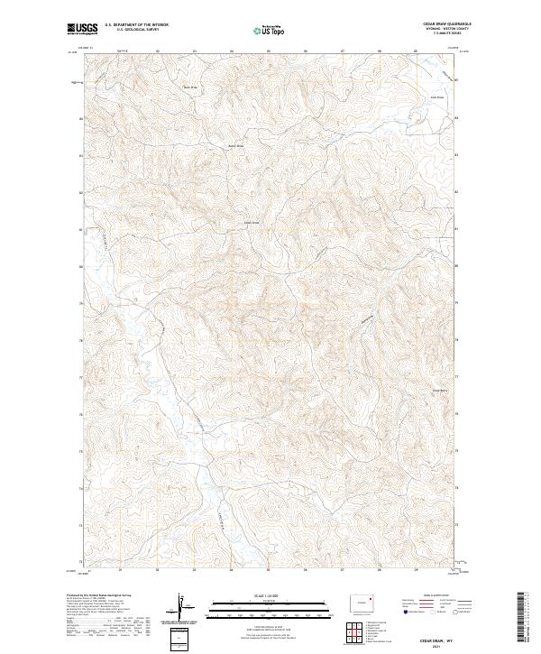
2021 Map of Cedar Draw
USGS Topo · Published 2021About this map
Chalk Butte stands as a prominent topographical landmark in this northeastern Wyoming landscape, overlooking a complex system of seasonal drainage channels. The terrain is defined by a series of named draws, including Buck Draw, Butler Draw, and the central Cedar Draw, which reveal the erosional patterns characteristic of the High Plains. These features, along with Coal Draw and Alkali Draw, suggest the local mineral and soil composition that has historically influenced land use in Weston County.
Find a feature on this map
17 named features on this map. Tap any name to fly to it.
Don’t see what you’re looking for? This feature index may not catch every label — zoom into the map to look around manually.
Map Details
Editions of this 2021 Cedar Draw Map
This is the sole edition of this map. No revisions or reprints were ever made.
Other maps of this area

1918 · Moorcroft
USGS Topo · 1:125,000

1954 · Gillette
USGS Topo · 1:250,000

1955 · Newcastle
USGS Topo · 1:250,000

1955 · Gillette
USGS Topo · 1:250,000

1958 · Gillette
USGS Topo · 1:250,000

1958 · Newcastle
USGS Topo · 1:250,000

1962 · Gillette
USGS Topo · 1:250,000
1971 · Whitetail Creek SE
USGS Topo · 1:24,000
1971 · Jim Creek
USGS Topo · 1:24,000
1971 · Whitetail Creek NE
USGS Topo · 1:24,000