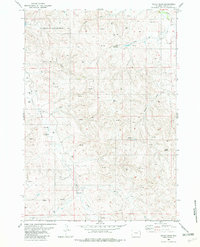
1982 Map of Cedar Draw
USGS Topo · Published 1982About this map
South Coyote Creek Oil Field dominates the northern landscape of this Wyoming quadrangle, illustrating the intensive energy extraction characteristic of the region in the early 1980s. The terrain is defined by a dense network of industrial markers, with numerous Drill Holes, Oil Wells, and Flowing Wells scattered across the undulating draws and ridges. These industrial features contrast with traditional topographic landmarks like Chalk Butte, highlighting the era's focus on sub-surface resources.
Find a feature on this map
13 named features on this map. Tap any name to fly to it.
Don’t see what you’re looking for? This feature index may not catch every label — zoom into the map to look around manually.
Map Details
Editions of this 1982 Cedar Draw Map
This is the sole edition of this map. No revisions or reprints were ever made.
Other maps of this area

1918 · Moorcroft
USGS Topo · 1:125,000

1954 · Gillette
USGS Topo · 1:250,000

1955 · Newcastle
USGS Topo · 1:250,000

1955 · Gillette
USGS Topo · 1:250,000

1958 · Gillette
USGS Topo · 1:250,000

1958 · Newcastle
USGS Topo · 1:250,000

1962 · Gillette
USGS Topo · 1:250,000
1971 · Whitetail Creek SE
USGS Topo · 1:24,000
1971 · Jim Creek
USGS Topo · 1:24,000
1971 · Whitetail Creek NE
USGS Topo · 1:24,000